|
This product is for informational purposes only and may not have been prepared for or be suitable for legal, engineering, or surveying purposes. It does not represent an on-the-ground survey and represents only the approximate relative location of property boundaries. This disclaimer is required per Texas House Bill 1147. Use of these maps implies that you you accept this disclaimer! |
Runaway Bay is in the process of updating its plat and zoning maps. The following maps are the most current. Please check with Runaway Bay City Hall or the Planning and Zoning Board for the most current information BEFORE planning to build! To better understand the maps, this document lists the various types of zones available in Runaway Bay with a brief description of each.
NEW: For the latest information on property ownership and legal descriptions, use the Wise Central Appraisal District - Runaway Bay Map
CURRENT MAPS
| Map Date | Map Description | Standard Resolution | High Resolution |
|---|---|---|---|
|
Aug |
Runaway Bay Official Zoning Map - 2020 |  |
Download PDF |
| 2004 | Runaway Bay, TX aerial map with city limits, ETJ, and Plats |  |
2004 Plat Map |
| OLD | Runaway Bay, TX zoning map - this map is for historic purposes as it includes neither areas that have been incorporated into Runaway Bay or zoning changes since the map's creation sometime before 2004. | 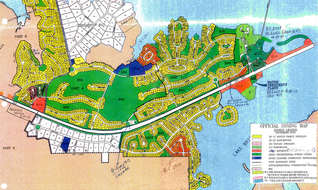 |
Zoning Map |
RBEDC - Land Use Plan
2017 - The Runaway Bay Economic Development Corporation is responsible to make Land Use and Zoning Change Requests to the P&Z and City Council to help direct development of Runaway Bay and it's Extra Territorial Jurisdiction (ETJ). The EDC is beginning to work on this project and maps are available here for that discussion.